Walkability for Tourists
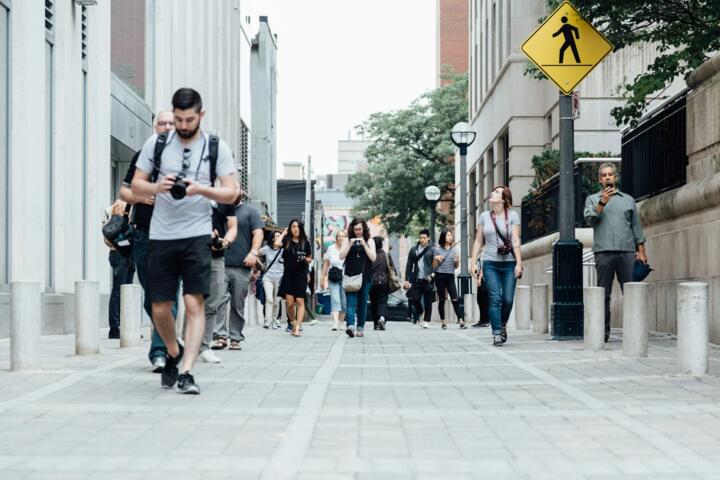
A walkable city lets travelers cover essential spots on foot with ease and safety. Cities like Copenhagen and Kyoto often rate above 80 on the Walk Score index, meaning most daily needs are within a short walking distance. Walkability focuses on street connectivity, pedestrian infrastructure, and mixed land use, shaping how someone experiences a place without relying heavily on vehicles.
In practice, a walkable area has wide sidewalks, frequent crosswalks, and direct routes to attractions, hotels, or transport hubs. This design cuts travel time significantly. For instance, if you can reach five popular sites within 30 minutes of walking, you’re in a walkable zone — skipping taxi fares, ticket queues, and transit waits.
Getting off a bus or train and walking directly to a restaurant or museum without confusion counts too. City walkability isn’t just about miles; it’s about the environment making walking pleasant, safe, and purposeful.
This matters for travelers, who often have limited time and budget, plus an appetite for immersion in local life. Good walkability shifts the experience from passive touring to active discovery.
Challenges Travelers Face
Travelers routinely mistake compactness for walkability. Compact cities can still have dangerous or uninviting pedestrian environments. Rio de Janeiro’s downtown is dense but many streets lack safe crossings or consistent sidewalks, posing risks.
Ignoring walkability leads to wasted time or missed sights. A city may appear friendly on the map but feel hostile on foot: uneven pavements, aggressive traffic, or missing street signs cause constant detours and stress.
Another common trap involves overestimating local public transport coverage as a replacement for walkability. Even the best bus lines often leave a “last mile” gap that can be frustrating, especially with luggage or kids.
When travelers don’t plan around walkability, they spend more on taxis or rideshares. This inflates trip costs and increases exposure to traffic delays. The fatigue from poorly planned routes diminishes the quality of experience.
Some urban areas also suffer from poor nighttime walkability due to inadequate lighting or unsafe neighborhoods, another hidden obstacle for visitors aiming to explore late.
Enhance Traveler Walkability
Use Walk Score Tools
Walk Score and Citymapper offer quantitative data and route options. These show pedestrian-friendliness isn’t guesswork. Walk Score, for example, ranks over 2,500 cities worldwide to help identify walkable districts. Numbers matter: a score above 70 means daily errands can be done on foot.
Plan Accommodations Near Core Areas
Choosing hotels in established downtowns, such as central Madrid or old Tallinn, guarantees proximity to key attractions. It avoids the dreaded taxi rides over bridges or across highways that break walkability. A well-chosen base can cut daily walking distance in half, doubling free exploration time.
Check Infrastructure Reviews
Apps like Google Maps and Street View reveal sidewalk widths, curb ramps, and crosswalks beforehand—even photos from other travelers on TripAdvisor sometimes include sidewalk images. You won't guess these on arrival.
Avoid Distracting Traffic Zones
Certain neighborhoods, despite charm, have heavy vehicular flow or lack pedestrian priority. Travelers should examine local maps for one-way streets, traffic calming features like speed bumps, or pedestrian-only zones. Tokyo’s Ginza district locks vehicle access after 1 PM on weekends; this enhances walkers' freedom and safety.
Time Walks Outside Peak Traffic
Rush hours turn even walkable streets into crowded, noisy paths. Early afternoons or late mornings often make better walking experiences in most cities.
Wear Proper Footwear and Carry Light
A personal detail: I once underestimated cobbled streets' strain and switched shoes mid-trip (2019, version 3 of my travel gear checklist). What you wear affects how much city you can comfortably explore.
Use Local Pedestrian Apps
Some cities have dedicated walking apps with curated routes (Berlin Walking Tours, Seoul Walker). These apps highlight lesser-known paths with great walkability and historical or cultural insights.
Combine Walking with Public Transport
When distances exceed comfortable range (more than 3-4 km), mix walking with metro or tram rides. For example, Prague’s trams cover routes where walking is impractical at night or in bad weather.
Respect Local Norms and Safety
Even walkable areas vary by culture. In some cities, jaywalking is common and expected; in others, it’s fined. Reading local pedestrian habits helps avoid fines or unsafe encounters.
Examples of Walkability in Practice
Amsterdam’s city center offers a clear example. The municipality’s 2019 plan boosted sidewalk space by 20% and added over 400 bike parking spots. This lowered car use by 15% in tourist-heavy areas, according to their transport department. Tourists report average walking distances of 2-3 km per day within the canal ring, reducing transit expenses significantly.
In contrast, Los Angeles, despite having large urban hubs, scores below 50 on Walk Score for most neighborhoods. Travelers often depend on Lyft or rental cars. That means less personal exploration outside scheduled tours or attractions, and more hassle with parking.
City guides often emphasize this gap: cities like Vancouver attract travelers with compact walkable neighborhoods, while sprawling cities require advanced planning for transit and taxi budgets.
Features Comparison
| Feature | High Walkability | Low Walkability | Example City |
|---|---|---|---|
| Sidewalk Width | Wide, >2m | Narrow, <1m | Amsterdam / LA |
| Crosswalks | Frequent, visible | Sparse, poorly marked | Tokyo / Rio |
| Traffic Speed | <40 km/h | >60 km/h | Vienna / Houston |
| Walk Score | 70–90+ | <50 | Vancouver / Atlanta |
Errors to Avoid
Planning a trip solely on transport availability displays a narrow view of walkability. Using ride apps exclusively for short distances wastes money and time.
Ignoring weather conditions disrupts walking plans: heatwaves or rainstorms can turn walks into unpleasant chores. Portable rain gear or hydration become non-negotiable.
Assuming all sidewalks will be continuous misleads travelers into detours. Many cities feature gaps due to construction or local regulations. Consulting updated maps helps.
Relying only on printed city guides often leads travelers astray in newer neighborhoods with recent infrastructure changes. Online resources and forums provide quicker updates.
Walking while distracted with phones or heavy luggage transforms walkability into a hazard. Don’t underestimate packing light and planning hands-free navigation.
FAQ
How is walkability measured?
Walkability usually considers distance to key locations, pedestrian infrastructure quality, street connectivity, and safety. Walk Score combines these factors into a numeric rating.
Which cities are most walkable?
European cities like Amsterdam, Paris, and Barcelona, plus Asian cities like Tokyo and Singapore, score high due to dense mixed-use districts and excellent sidewalks.
Can I walk safely at night?
Nighttime walkability depends on lighting, crime rates, and local culture. Research neighborhoods specifically for nighttime safety before plans.
Is walkability the same as pedestrian-friendly?
Not exactly. Pedestrian-friendly focuses on comfort and design quality; walkability includes the functional element—how efficiently you can reach destinations on foot.
Are walkability scores reliable for travelers?
They serve as strong general indicators but miss subjective factors like personal fitness or local hazards. Always complement them with updated local info.
Author's Insight
After years exploring dozens of cities, I’ve learned walkability shapes travel memories more than landmarks do. In 2022, I stayed in Lisbon’s Alfama, easily walking 4 km daily and discovering alleys missed by tour buses. The freedom changed everything. Yet, I’ve also felt stuck in sprawling cities with poor walk paths, regretting each taxi fare. Walking isn’t just transport—it’s engagement with place.
Key Takeaways
Walkable cities save time, reduce expenses, and deepen cultural immersion. Travelers should evaluate city design beyond maps, using walk scores and infrastructure checks. Packing smart and planning routes enhance the experience further, turning urban visits into genuine explorations on foot.