Southern Cone Reality
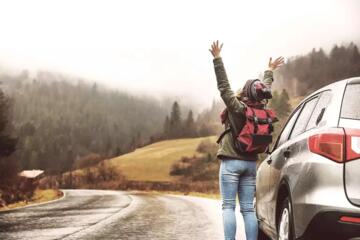
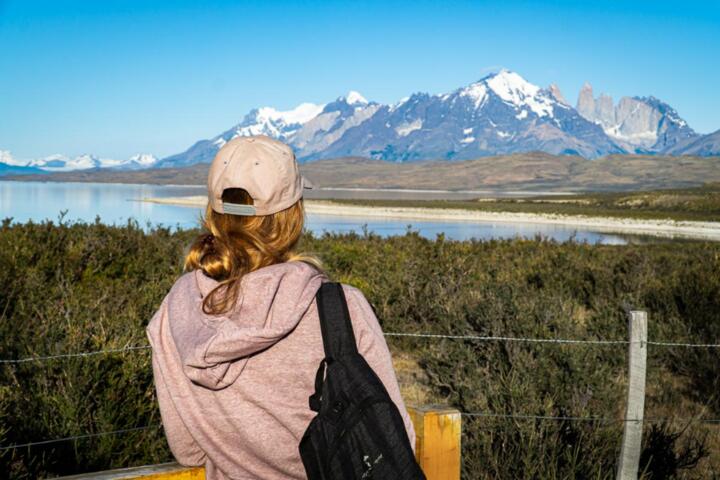
Patagonia is not a single destination but a vast territory spanning over 1 million square kilometers across Chile and Argentina. It is defined by the "Roaring Forties" and "Furious Fifties" latitudes, where air masses from the Pacific collide with the Andes, creating weather patterns that can shift from 20°C sunshine to 80 km/h gale-force winds in under an hour. For a first-timer, understanding the distinction between the granite spires of Torres del Paine in Chile and the massive advancing glaciers of El Calafate in Argentina is crucial for itinerary design.
Practical experience shows that travelers often underestimate the scale. Driving from Puerto Natales to El Chaltén involves crossing an international border and navigating approximately 450 kilometers of often unpaved or wind-swept roads, such as the iconic Ruta 40. Statistically, the region sees its peak visitation from December to February, yet "shoulder season" (October-November and March-April) offers a 30% reduction in crowd density and significantly more stable light for photography.
Critical Pitfalls
The most significant mistake made by novices is "itinerary bloating"—attempting to see both Northern and Southern Patagonia in a single 10-day window. This results in spending more time in transit (on buses or flights via Santiago or Buenos Aires) than on the trails. Another frequent failure is relying on standard "waterproof" gear; Patagonia requires high-performance membranes like GORE-TEX Pro or eVent, as standard DWR (Durable Water Repellent) coatings often fail under the relentless horizontal rain typical of the region.
The consequences of poor logistical planning are expensive. For instance, the CONAF-regulated campsites on the "W" Trek in Torres del Paine often sell out six months in advance. Travelers who arrive in Puerto Natales without reservations through Vertice or Las Torres (the two primary concessionaires) are frequently turned away at the park gates, forced to book last-minute hotels costing upwards of $500 per night. Real-world situations often involve travelers losing a full day of trekking because they didn't account for the 4-hour border crossing queue at Paso Río Don Guillermo.
Strategic Recommendations
Securing Trail Access and Logistics
For the Chilean sector, you must utilize the CONAF booking portal and the private affiliate sites Vertice Patagonia and Las Torres. For the "W" Circuit, book east-to-west to keep the wind at your back. In Argentina, use the Plataforma Central de Pasajes to secure long-haul bus tickets between El Calafate and El Chaltén, which is the "Trekking Capital of Argentina." This ensures you aren't stranded during the high-demand morning departures.
Mastering the Layering System for 100km/h Winds
Forget heavy parkas. The "Rule of Three" is the standard: a moisture-wicking merino wool base layer (Smartwool or Icebreaker), a synthetic mid-layer (Patagonia Nano Puff or similar), and a technical hardshell. Avoid down insulation in wet conditions unless it is "treated" hydrophobic down, as wet feathers lose all thermal properties. Data shows that wind chill can drop the perceived temperature by as much as 10 degrees, making a high-quality windproof buff and gloves non-negotiable.
Navigating Currency and Connectivity
While the "Blue Dollar" rate in Argentina has historically favored cash, the introduction of the MEP (Electronic Payment Market) rate for foreign credit cards has made Visa and Mastercard usage more efficient and safe. Carry CLP (Chilean Pesos) for small tolls in the south. For connectivity, download Airalo or Holafly eSims, but realize that deep inside Los Glaciares National Park or the French Valley, GPS works, but cellular data is non-existent. Offline maps like Maps.me or Gaia GPS are essential.
Optimizing Glacier Observation
To see the Perito Moreno Glacier, avoid the standard midday tour buses that arrive at 11:00 AM. Instead, hire a private transfer or rent a car via Hertz or Localiza in El Calafate to arrive at the boardwalks by 8:00 AM. This provides a three-hour window of solitude before the mass tourism influx. For a more immersive experience, book the "Big Ice" trek through Hielo y Aventura, the only operator licensed for ice trekking on Perito Moreno.
Biological and Environmental Compliance
The Chilean SAG (Agricultural and Livestock Service) is incredibly strict. Do not attempt to cross the border with honey, fresh fruit, or unsealed nuts. Fines start at approximately $200 and can escalate quickly. Ensure all camping gear is cleaned of seeds and soil to prevent the spread of invasive species like Didymosphenia geminata (Rock Snot), which threatens Patagonian waterways.
Real-World Deployment
Case Study 1: The Optimized "W" Circuit
A couple from London planned a 5-day trek in Torres del Paine. Initially, they found all "Refugios" (hostels) fully booked. By using the BookingPatagonia aggregator service, they identified a cancellation and secured a "Fully Equipped Tent" option. By opting for the full board meal plan (Pensión Completa), they reduced their pack weight by 4kg each. Result: They completed the 80km circuit without injury, maintaining a consistent pace of 4km/h, and saved 15 hours of food preparation time.
Case Study 2: Independent Exploration in El Chaltén
A solo traveler bypassed the expensive organized tours in El Calafate and spent 7 days in El Chaltén. By utilizing the Windy.app (using the ECMWF model) to predict weather windows, they timed their ascent to Laguna de los Tres for a clear sunrise on Mount Fitz Roy. Result: Zero cost for park entry (El Chaltén trails are free) and successful photography of the "Alpenglow" effect, which only occurs in specific atmospheric conditions.
Essential Comparison
| Feature | Chilean Side (Torres del Paine) | Argentine Side (El Chaltén/Calafate) |
|---|---|---|
| Primary Landscape | Granite Towers, Fjords, Turquoise Lakes | Massive Glaciers, Vertical Spires, Steppe |
| Access Fees | High ($35 - $50 USD approx.) | Free (Chaltén) / Mid-range (Calafate) |
| Logistical Difficulty | High (Requires months of pre-booking) | Moderate (More walk-up flexibility) |
| Accommodation Type | Refugios and remote campsites | Town-based hotels and free backcountry camps |
| Best For | Multi-day thru-hiking | Day hikes and glacier trekking |
Common Errors
Do not trust the estimated hiking times on trail signs implicitly. Patagonian "flat" often involves significant undulation, and the wind can double your exertion levels. A 20km hike in Patagonia is physically equivalent to 30km in more temperate climates. Furthermore, many travelers forget to register their trekking plans with the Guardaparques (Park Rangers). In the event of an emergency, these logs are the only way Search and Rescue (SAR) teams can locate you.
Avoid exchanging all your money at the airport. Use ATMs in larger hubs like Punta Arenas or El Calafate to get better rates. Additionally, never leave your rental car with less than half a tank of fuel. In the Argentine Steppe, gas stations (YPF) can be 200km apart, and it is not uncommon for them to run out of fuel for several days if the supply truck is delayed by weather.
FAQ
What is the best month to visit to avoid the wind?
While wind is a constant, late March and early April (Autumn) typically see a decrease in wind velocity compared to the spring months of October and November. This is also when the Lengas trees turn vibrant red.
Do I need a professional guide for the major treks?
No, the trails in Torres del Paine and El Chaltén are exceptionally well-marked. A guide is only necessary for technical mountaineering, ice trekking (mandatory), or if you desire deep historical and geological context.
Is the water in the streams safe to drink?
In the backcountry of most national parks, the water is glacial-fed and generally considered some of the purest on earth. However, due to the presence of cattle in some border areas, using a Sawyer Squeeze or LifeStraw is a recommended precaution.
How do I get between the Chilean and Argentine parks?
The most common route is the bus from Puerto Natales (Chile) to El Calafate (Argentina). Companies like Bus-Sur offer daily services. The journey takes 5-7 hours depending on border processing times.
Can I fly directly into Patagonia?
There are no international flights directly into the heart of Patagonia. You must fly into Santiago (SCL) and then to Puerto Natales (PNT) or Punta Arenas (PUQ), or fly into Buenos Aires (EZE/AEP) and then to El Calafate (FTE).
Author’s Insight
Having spent three seasons navigating the southern massifs, my most vital piece of advice is to "embrace the delay." I once spent three days in a tent waiting for the wind to drop below 70 km/h just to cross the Gardner Pass. Those who rush Patagonia often leave disappointed because the mountains were obscured by clouds. Build "buffer days" into your schedule—at least one for every four days of trekking. The most profound moments I've had weren't on the summits, but during the forced stillness of a storm, watching the sheer power of the Southern Ice Field from a distance.
Summary
Planning a debut trip to Patagonia requires a shift from "vacation mode" to "expedition mode." By prioritizing high-quality technical layers, securing trail permits six months in advance through official portals like CONAF, and respecting the logistical hurdles of the Chilean-Argentine border, you ensure a journey defined by awe rather than frustration. Focus on one region, monitor the wind speeds via reliable meteorological tools, and always carry a physical map as a backup to your digital devices. The wilderness is unforgiving, but for the prepared traveler, it offers an unparalleled connection to the rawest elements of our planet.